€50
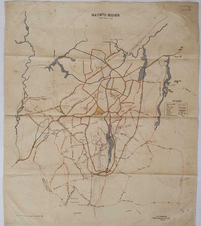
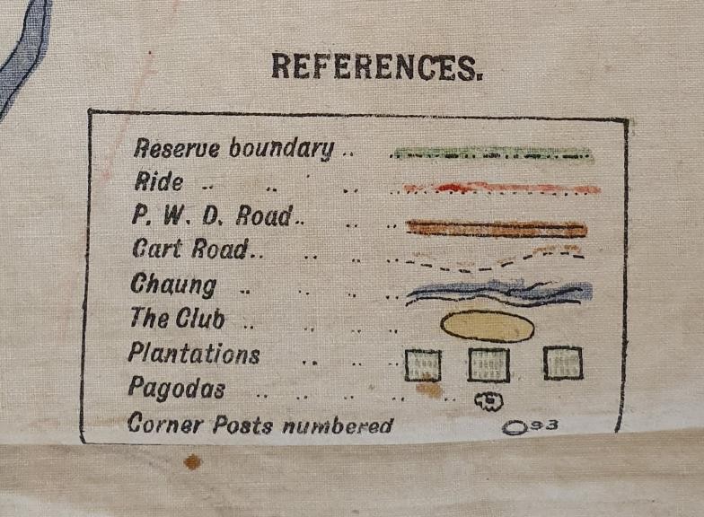
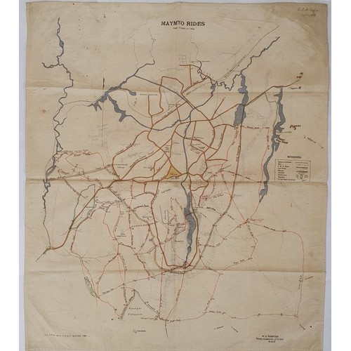
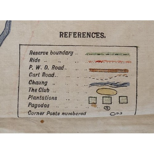
Unique Map of Forests of Burma 1912. Title ‘Maymo Rides’. Map by W. A. Robertson, Deputy Conservator of forests, 24/6/1912. Scale 4 inches to 1 mile. Large format 60cm by 70 cm on white cloth. Some details printed, others including coloured lines are by hand. Map covering area between Mandalay and Lashio. Unique map from a time when Britain exploited the great teak forest of Burma.
Fees apply to the hammer price:
Room and Absentee Bids:
23.37% inc VAT*
Online and Autobids:
27.06% inc VAT*